Welcome to the FRM4DOAS website
Fiducial Reference Measurements (FRM) are a suite of independent, fully characterized, and traceable ground measurements that follow the guidelines outlined by the GEO/CEOS Quality Assurance framework for Earth Observation (see http://qa4eo.org). These FRM provide the required confidence in data products, in the form of independent validation results and satellite measurement uncertainty estimation, over the entire end-to-end duration of a satellite mission (more information available here).
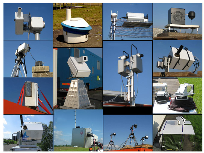
Image courtesy of A. Piters (KNMI)
The Fiducial Reference Measurements for Ground-Based DOAS Air-Quality Observations (FRM4DOAS) is an ESA activity which started in July 2016 under the contract n°4000118181/16/I-EF.
This activity aims at further harmonizing MAX-DOAS systems and data sets, through the following tasks:
- Specification of best practices for instrument operation
- Development of the first centralised NRT (near-real-time/6-24h latency) processing system for MAX-DOAS instruments operated within the international Network
for the Detection of Atmospheric Composition Change (NDACC) and launch of the NDACC MAX-DOAS Service in a demonstration mode.
The target MAX-DOAS products for the first phase of the project (July 2016 - August 2021) were tropospheric and stratospheric NO2 vertical profiles, total O3 columns, and tropospheric HCHO profiles. - Establishment of links with other UV-Visible instrument networks, e.g. PGN
The end objective is to produce homogenous ground-based reference datasets from instruments being operated at long-term monitoring sites (e.g. NDACC) or during field campaigns.
Such reference data sets will play a crucial role in the validation of future atmospheric composition satellite missions, in particular the ESA Copernicus Sentinel missions S-5P, S-4, and S-5.
In September 2021, the follow-up project called FRM4DOAS-2.0 started under the ESA contract n°4000135355/21/I-DT-Ir, focussing on the following Research and Development tasks:
- Consolidation of the existing stratospheric NO2 vertical profile product through the optimisation of the current retrieval settings
- Development of a near-real-time cloud product: Clouds and in particular rapidly varying cloud conditions are known to potentially strongly impact the retrieval of trace gas vertical profiles
from MAX-DOAS measurements. It is therefore useful to identify and classify cloud conditions for each MAX-DOAS measurement in order to characterise the quality of the retrieval.
This is also an important ancillary information for interpreting satellite validation results involving MAX-DOAS data. - Development of a consolidated MAX-DOAS aerosol product: The retrieval of aerosol extinction vertical profiles is the first step of the trace gas profile retrieval.
The optimisation of the current retrieval settings leading to a consolidated MAX-DOAS aerosol product, are further investigated. - Development of an advanced urban tropospheric NO2 product: The high spatial and temporal variations of the NO2 concentration over urban areas,
despite the scientific interest in studying them, can also pose challenges for the MAX-DOAS vertical profiling and for validation of air-quality satellite observations in those conditions.
New MAX-DOAS instrument viewing modes and associated retrieval approaches are further investigated in order to develop an advanced MAX-DOAS NO2 product for urban conditions.
These new research activities in the MAX-DOAS FRM context are highly desired in order to further improve and consolidate existing retrieval algorithms
but also to extent the central processing service to new data products that are also relevant for satellite validation studies.

![]()


![]()

![]()
![]()
![]()